
Class 10 Social Question and Answer: India – Transport and Communication
Looking for SSLC Class 10 Social Science Studies textbook answers? You can download Chapter 8 : India – Transport and Communication Questions and Answers PDF, Notes, and Additional Q&A here. SSLC Social Science solutions follow the Karnataka State Board Syllabus, making it easier for students to revise and score higher in exams.
Karnataka SSLC Social Geography Textbook Answers—Reflections Chapter 8
India – Transport and Communication Questions and Answers, Notes, and Additional Q&A
Class 10 Geography Chapter 8
India – Transport and Communication
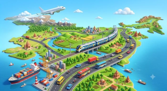
Scroll Down to Downlaod India – Transport and Communication PDF
I. Fill in the blanks with suitable words.
- The name of the international airport of Bengaluru is Kempegowda International Airport.
- For the development of villages and agriculture, road transport is necessary.
- The Mumbai port is called “Gateway of India”.
- The tea port of India is Kolkata.
II. Answer the following questions in brief.
Question 1.
What is the importance of roads in India?
Answer:
Roads are important for the development of villages and agriculture. They help farmers transport agricultural produce to markets and supply essential commodities to villages. Roads also connect villages with towns, cities and railway stations.
Question 2.
What are the four types of major roads?
Answer:
The four types of roads are:
- National Highways
- State Highways
- District Roads
- Village Roads
Question 3.
What is meant by the Golden Quadrilateral Project?
Answer:
The Golden Quadrilateral is a network of national highways connecting the four major metropolitan cities of Delhi, Mumbai, Chennai and Kolkata through four- or six-lane roads.
Question 4.
Make a list of major ports in India.
Answer:
The major ports mentioned in the chapter are:
- Kandla
- Mumbai
- Nhava Sheva
- Marmagao
- New Mangaluru
- Kochi
- Tuticorin
- Chennai
- Visakhapatnam
- Paradip
- Kolkata
- Haldia
Question 5.
List out the problems of road transport in India.
Answer:
The major problems of road transport in India are:
- Many village and district roads become unfit for use during the rainy season.
- Road transport causes environmental pollution and accidents.
- Roads suffer damage due to rain, floods and cyclones.
- Construction and maintenance of national and state highways are inadequate.
- Basic facilities along roadsides are insufficient in many areas.
Question 6.
What is communication media? Which are they?
Answer:
Communication media are the means used to exchange information and communicate with people. They include posts, newspapers, radio, television, satellites, computer networks, the internet, email and mobile phones.
Question 7.
Mention the importance of communication.
Answer:
- It helps people learn about events happening in different places.
- It makes people aware of government policies.
- It spreads information about agriculture and industries.
- It supports trade and commerce.
- It promotes national unity, integration and stability.
Question 8.
How is GPS different from GIS?
Answer:
GPS (Global Positioning System) identifies the exact location of a person or object using latitude, longitude and altitude. GIS (Geographical Information System) collects, stores, analyses and displays geographical information about the Earth’s surface.
Question 9.
Write about Remote Sensing Technology.
Answer:
Remote sensing is a technology used to collect information about the Earth’s surface without physically touching the objects. It uses aerial photographs and satellite images to gather geographical information.
It helps in studying natural resources, land use, forests, water bodies, crop distribution and natural disasters such as floods, droughts and cyclones.
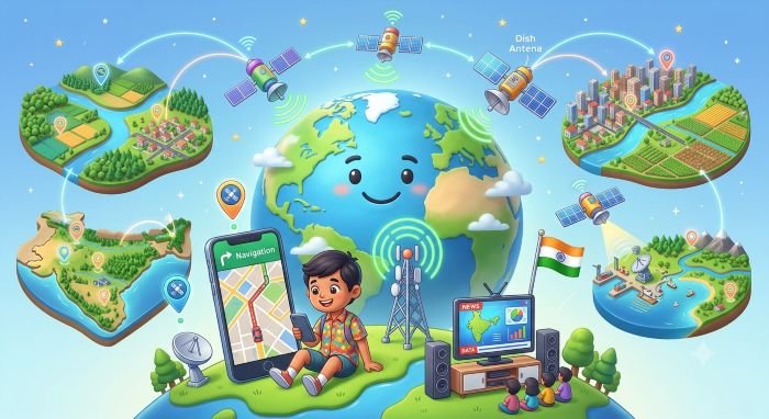
Additional Important Questions and Answers
Question 1.
What is transport?
Answer:
Transport is the movement of goods, services, information and materials from one place to another.
Question 2.
What are the four important types of transport?
Answer:
The four important types of transport are road transport, rail transport, water transport and air transport.
Question 3.
Why is transport important for the economic development of India?
Answer:
Transport connects agriculture, industries, mining, forestry and fisheries with markets. It helps move goods and people quickly and supports the economic development of the country.
Question 4.
Which is the longest National Highway in India?
Answer:
NH-44 is the longest National Highway in India. It extends from Srinagar in Jammu and Kashmir to Kanyakumari in Tamil Nadu.
Question 5.
When was the National Highways Authority of India established?
Answer:
The National Highways Authority of India (NHAI) was established in 1988 and began functioning in 1995.
Question 6.
Where was GIS first established, and when?
Answer:
Geographical Information System (GIS) was first established in Canada in 1960.
Question 7.
Mention any four uses of GIS.
Answer:
- It helps prepare accurate geographical maps.
- It analyses land use and soil distribution.
- It supports the management of natural resources.
- It helps provide advance information about weather-related events.
Question 8.
What is the role of satellites in GPS?
Answer:
Satellites transmit signals containing information that GPS receivers use to calculate the location of a person or object.
Question 9.
Mention any four uses of Remote Sensing Technology.
Answer:
- It helps study forests and water resources.
- It provides information about crop distribution and land use.
- It helps monitor floods, droughts and cyclones.
- It supports the study of coastal areas and soil erosion.
Question 10.
What is the difference between road transport and rail transport?
Answer:
Road transport uses roads and vehicles to carry goods and passengers, especially over short distances. Rail transport uses trains and is particularly useful for carrying heavy goods and large numbers of passengers over long distances.
Multiple-Choice Questions (MCQs) with Answers
- What is the movement of goods and people from one place to another called?
A) Communication
B) Transport
C) Agriculture
D) Industry
Answer:
B) Transport
- Which of the following is NOT a major type of transport?
A) Road transport
B) Rail transport
C) Air transport
D) Underground farming
Answer:
D) Underground farming
- Which type of road connects the major cities and state capitals of India?
A) Village roads
B) District roads
C) National Highways
D) Forest roads
Answer:
C) National Highways
- When was the National Highways Authority of India (NHAI) established?
A) 1953
B) 1988
C) 1995
D) 2000
Answer:
B) 1988
- Which is the longest National Highway in India, according to the chapter?
A) NH-7
B) NH-27
C) NH-44
D) NH-48
Answer:
C) NH-44
- The Golden Quadrilateral connects which four metropolitan cities?
A) Delhi, Mumbai, Chennai and Kolkata
B) Bengaluru, Hyderabad, Pune and Jaipur
C) Delhi, Bengaluru, Kochi and Patna
D) Mumbai, Lucknow, Bhopal and Guwahati
Answer:
A) Delhi, Mumbai, Chennai and Kolkata
- The North–South Corridor connects Srinagar with which place?
A) Mumbai
B) Chennai
C) Kolkata
D) Kanyakumari
Answer:
D) Kanyakumari
- The East–West Corridor connects Porbandar with which place?
A) Srinagar
B) Silchar
C) Chennai
D) Mumbai
Answer:
B) Silchar
- When was the first railway line opened in India?
A) 15 August 1947
B) 26 January 1950
C) 16 April 1853
D) 1 May 1901
Answer:
C) 16 April 1853
- The first railway line in India connected Mumbai with which place?
A) Thane
B) Pune
C) Nashik
D) Nagpur
Answer:
A) Thane
- Which is the most important port in Karnataka?
A) Kochi
B) Chennai
C) New Mangaluru
D) Paradip
Answer:
C) New Mangaluru
- Which port is called the “Tea Port of India”?
A) Mumbai
B) Kolkata
C) Kandla
D) Chennai
Answer:
B) Kolkata
- Which port is a natural port in Andhra Pradesh?
A) Visakhapatnam
B) Tuticorin
C) Haldia
D) New Mangaluru
Answer:
A) Visakhapatnam
- Which is the fastest means of transport?
A) Road transport
B) Rail transport
C) Water transport
D) Air transport
Answer:
D) Air transport
- What is the full form of AAI?
A) Airport Administration of India
B) Airports Authority of India
C) Air Association of India
D) Aviation Agency of India
Answer:
B) Airports Authority of India
- What is mass communication?
A) Communicating with one person only
B) Transporting goods by road
C) Reaching a large number of people at the same time
D) Sending goods by railway
Answer:
C) Reaching a large number of people at the same time
- Which of the following is a medium of mass communication?
A) Television
B) Plough
C) Tractor
D) Railway track
Answer:
A) Television
- Where was GIS first established?
A) India
B) Canada
C) Japan
D) Australia
Answer:
B) Canada
- What is the main function of GPS?
A) To construct roads
B) To measure rainfall only
C) To identify the location of a person or object
D) To manufacture satellites
Answer:
C) To identify the location of a person or object
- What is the Indian regional satellite navigation system called?
A) NASA
B) GIS
C) GPS
D) NavIC
Answer:
D) NavIC
- Which technology collects information about the Earth’s surface without physically touching objects?
A) Remote Sensing
B) Road Transport
C) Mass Communication
D) Rail Transport
Answer:
A) Remote Sensing
- Which technology helps analyse land use, soil and crop distribution?
A) GPS only
B) GIS
C) Air transport
D) Radio communication
Answer:
B) GIS
- Which of the following is a use of Remote Sensing Technology?
A) Operating railway stations
B) Constructing vehicles
C) Studying floods and cyclones
D) Manufacturing mobile phones
Answer:
C) Studying floods and cyclones
- Which transport is especially useful for carrying heavy goods over long distances?
A) Rail transport
B) Bicycle transport
C) Walking
D) Air transport only
Answer:
A) Rail transport
- Which of the following helps GPS receivers determine their location?
A) Newspaper reports
B) Roadside signs only
C) Railway tickets
D) Signals from satellites
Answer:
D) Signals from satellites